


by Alessandra Ressa
Trieste’s unique location allows for stunning views of mountains and sea wherever you go. Every time you look down from any place in Carso, you can’t help but feel blessed for living in such an inspiring part of the world.
On the hills there is a thick web of beautiful trails for every taste, from the rocky cliffs overlooking the sea, to the shady secluded woods, to historical paths covering literally thousands of years of civilizations and events. So here is one of those great Carso itineraries, combining nature, history, stunning views, good workout, and, most importantly, zero footprint.
You will need comfortable hiking shoes, appropriate clothing and water to cover a total distance of approximately 15 km. From Trieste’s Giardino pubblico inVia Giulia climb via Marconi all the way up to via Fabio Severo. Cross the street and take via Monte Cengio uphill for just a few meters, until you get to one of those typical, lovely Trieste’s sandstone stairways. That is the beginning of via Monte San Gabriele that marks the start of your climb up to Carso.
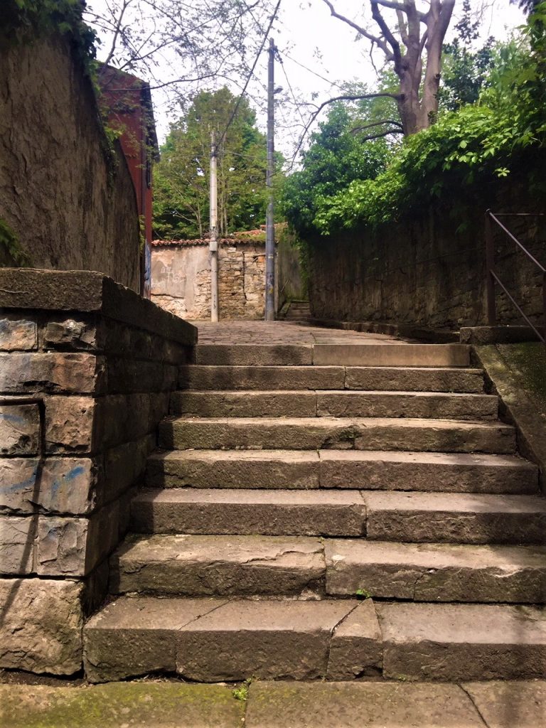
The initial pedestrian climb of via Monte San Gabriele is a little corner of what remains of Trieste’s “erte”, staircases and narrow alleys enclosed in tall stone walls, used by Triestini as vertical shortcuts to the many hills, avoiding the dirt and horse-and-carriage traffic of the few main roads in the past.
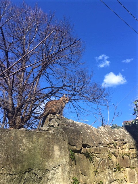
Luckily, many of these have survived, some are in awful state, covered in thorny bushes, steps and walls caved in. Only a handful of original houses have survived along this particular alley, and, if you are lucky, a colony of curious stray cats tended by “gattare” will greet your passage.
At the end of the pedestrian path via Monte San Gabriele proceeds uphill with tall, fragrant linden trees in bloom taking up the sidewalk. Continue your climb across via Cantù and follow via Monte San Gabriele until you will see a green turnstile to the left. That is the entrance to beautiful Villa Giulia park. Enter the gate and follow the cobbled-stone path uphill.
Villa Giulia is a big, beautiful, lush park with secular oaks and pines that climbs the hill from Scorcola to Cologna all the way to Strada Nuova per Opicina at the foot of Conconello village.
It was used by the Austro-Hungarian army as strategic post to control the gulf. Remains of bunkers, trenches and army barracks can still be found out here. Villa Giulia was later used by Nazi troops for the same reason, and immediately after by American forces, who built army barracks and sports facilities for the troops all the way to Campo Cologna. Right after you enter Villa Giulia, take the first gravel trail to the left.
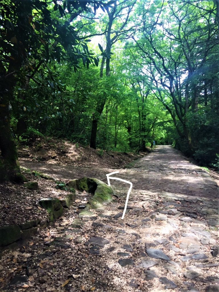
When you reach the top of the hill, you’ll see the tram tracks on your left. Keep following your trail to the right and you will soon pass the indoor tennis courts on your left. Keep following this beautiful trail in a more or less straight line. There will be some deviations and steep turns but keep going straight whenever possible to via Baiardi.
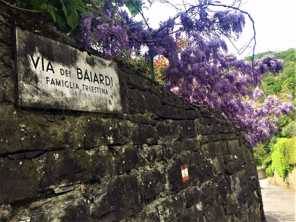
The trail ends clumsily in via Baiardi, a steep, very narrow, two-way residential street that often challenges even the most experienced Triestine drivers. Follow via Baiardi all the way up to Strada Nuova per Opicina. As there is no zebra crossing, be extremely careful when you cross this busy road. Once safely on the other side, take via del Sommacco to continue your climb to Sentiero (trail) De Rin.
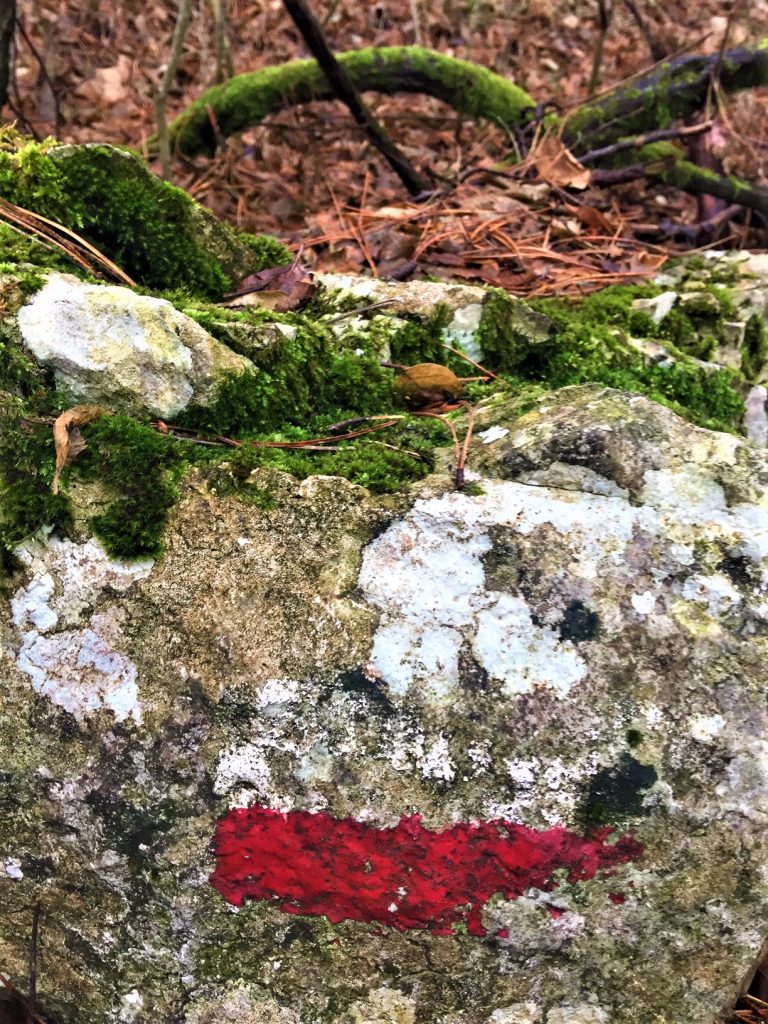
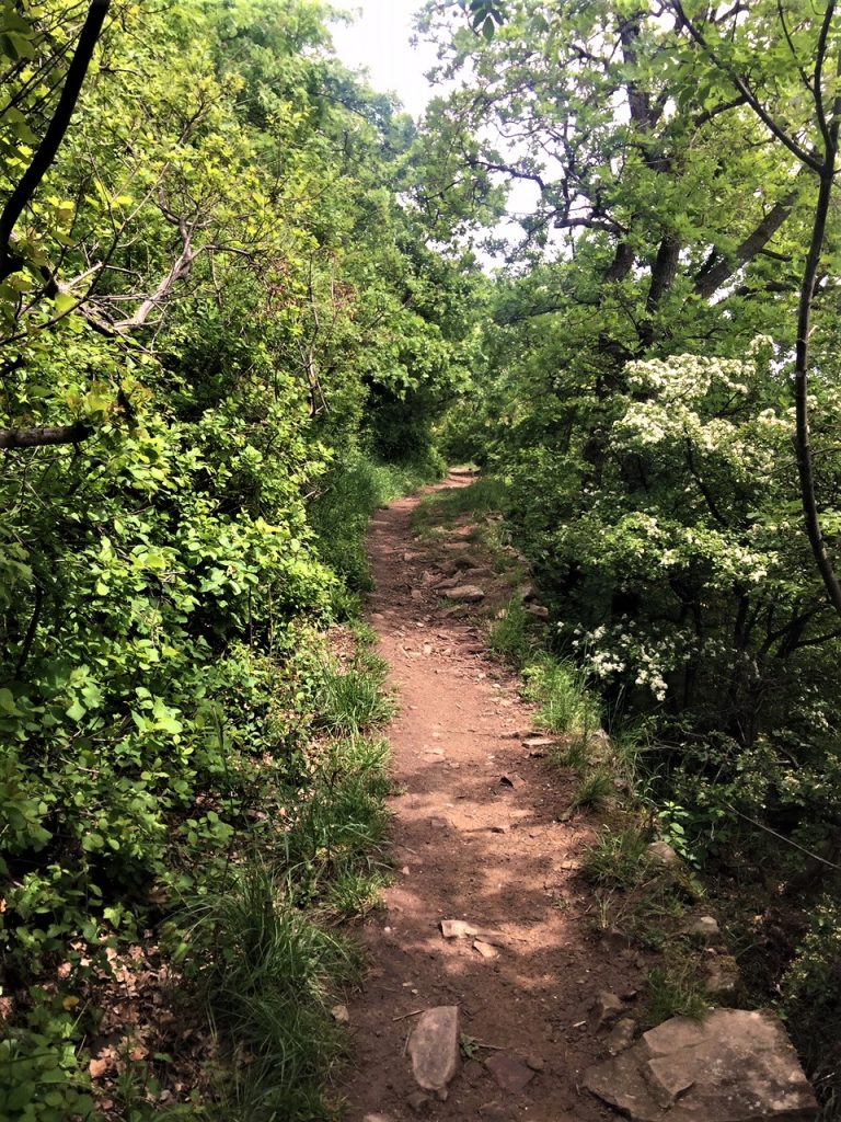
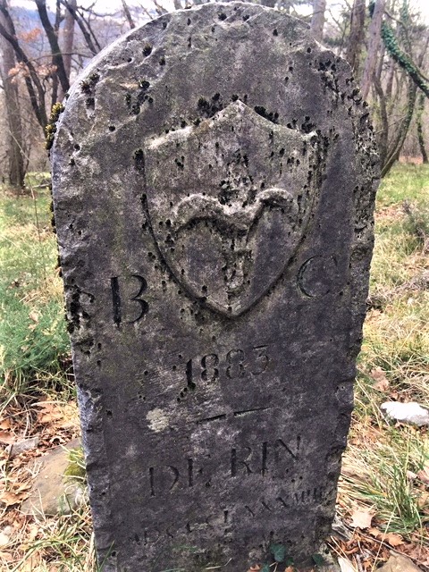
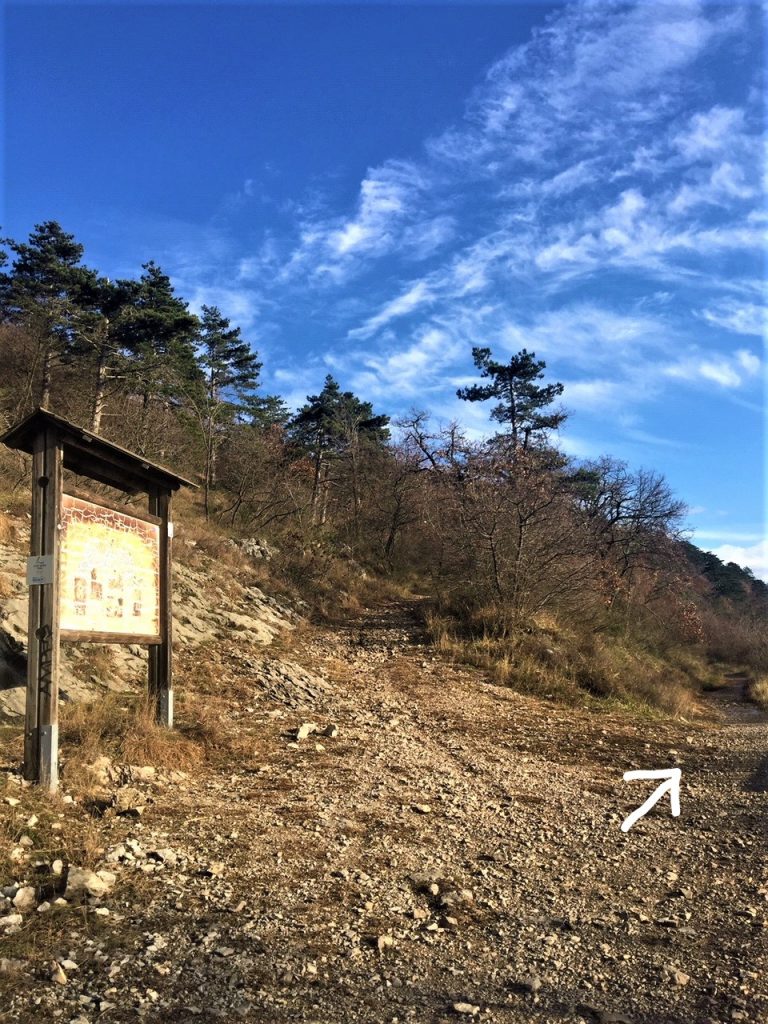
Via del Sommacco is an exclusive, residential area with a cluster of houses and a few mansions built on the edge of the wood. All the buildings enjoy breathtaking views of Trieste. Soon after the private park of the last mansion and the last bits of paved road, two trails begin. Take the trail to the right (n.2 with red-white sign on a tree) and follow it for about half a kilometer. If you see the old memorial stone to the right you are on the right trail.
You will soon reach a junction where an indecipherable information panel stands to remind us that you should never rely on signposting alone when hiking. The trail turning left, De Rin trail, will take you all the way to the beautiful village of Conconello and eventually to Opicina. The two trails to the right run parallel one above the other all the way to Park Globojner in Padriciano. The one above, n.2, is the prosecution of De Rin, while the one below is trail n. 18, the “milky way”, il Sentiero del Latte.
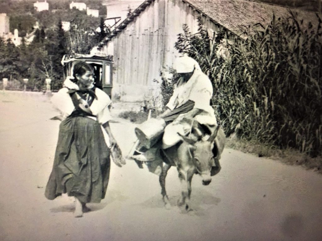
The “milky way”, Sentiero del Latte, between Trebiciano and Trieste, is the trail that historically connected Trebiciano village to the city. The first written documents referring to this path date back to the 1300s. It was mostly used by villagers who had to go to work or sell their goods in Trieste.
As the population in town increased, so did the demand for dairy products. Carso villages expanded as many people moved to these rural communities. At the beginning of 1800s milk became the main commercial product between Trebiciano and Trieste. Each morning, after milking the cows, women from the Slovenian minority, known as mlekarice (milk women), left the villages of Carso and walked down the trail carrying over 30 liters of milk on their heads in special tin containers. The luckier ones had mules.
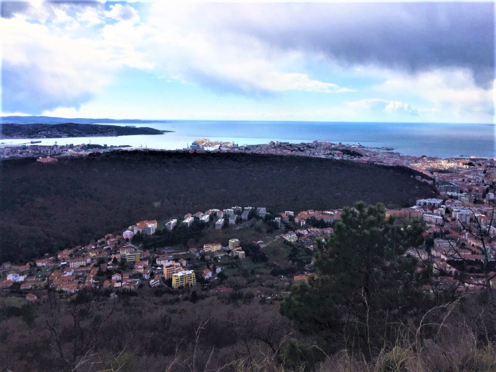
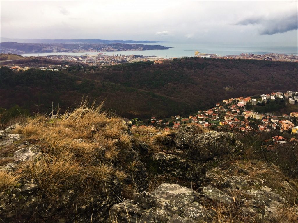
Sentiero del Latte offers breathtaking views of Trieste, so make sure you have your camera ready. You can see the whole city and as far away as Slovenia and Croatia. It is from here that you realize how vast and thick the “Boschetto” wood below is.
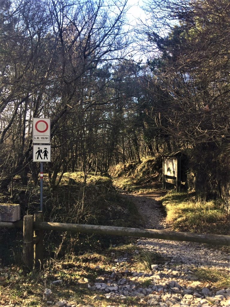
When you reach Globojner park you are in for another treat. Turn right at the end of the trail (if you go straight you’ll reach a parking lot) and take the path on your right with a wooden bar and the triangular sign (a very old fashioned, stereotypical sign I personally dislike). This is where the ancient Roman road begins.
Most of the original stones have disappeared or have been buried by dirt and more rocks, but some stone paving still remains and most historians have no doubt about its origins. The ancient Roman road, according to experts, connected Trieste to Postojna, and was probably built on an even older, prehistoric pathway. This theory is reinforced by the presence of a prehistoric fort (castelliere) on the nearby Mount Calvo dating back to the iron and bronze age.
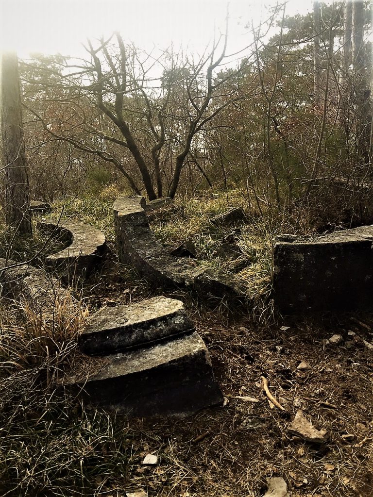
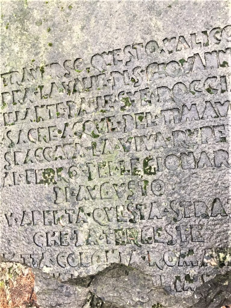
At the very beginning of your descent along the ancient Roman road look up to your left. You will see a huge monumental stone dangerously clinging to the steep dirt wall beside the trail. Climb up to it and look at the inscription.
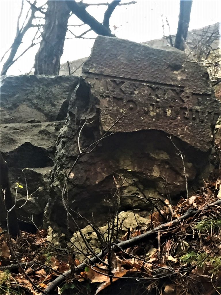
The stone was positioned at the entrance to the trail in 1939 and engraved in fascist-style letters with the following inscription: “Attraverso questo valico – sopra la valle di S. Giovanni – stillate dalle sue rocce le sacre acque del Timavo- spaccata la viva rupe dal ferro dei legionari di Augusto – fu aperta questa strada che Tergeste – fatta colonia romana dal fondatore dell’impero – portò le aquile romane a debellare i barbari alla porta orientale d’Italia” Through this entrance – above San Giovanni valley – shaped by the sacred waters of the Timavo river – the stone cut by the iron of Augustus’ Roman Legionnaires – this road was opened for Trieste – made a Roman colony by the founder of the Empire – (the city) which brought the Roman eagles to defeat the barbarians at its Eastern Italian door.
The stone was damaged during the events following the liberation of Trieste in 1945. As it was positioned on the road above, it was probably, and deliberately, damaged by a bomb in retaliation.
Further along that same side of the hill, above the Roman road, there is also an Austro-Hungarian military sentinel position that is worth the climb. It is difficult to see in spring and summer because of the thick vegetation surrounding it, but from its top in the fall and winter you can enjoy incredible views. Part of trenches dug in the rock are still quite well preserved. The sign ‘Sentinela’ has been positioned at the top.
From now on you can really enjoy your way down the Roman road making sure you look left and right at the view, the beautiful ancient walls covered in moss, the old stones paving the path. You will eventually reach via di Monte Spaccato (there is a Swiss-style chalet on the left that is quite entertaining and definitely out of place) and you’ll have once again to cross the main road with care.
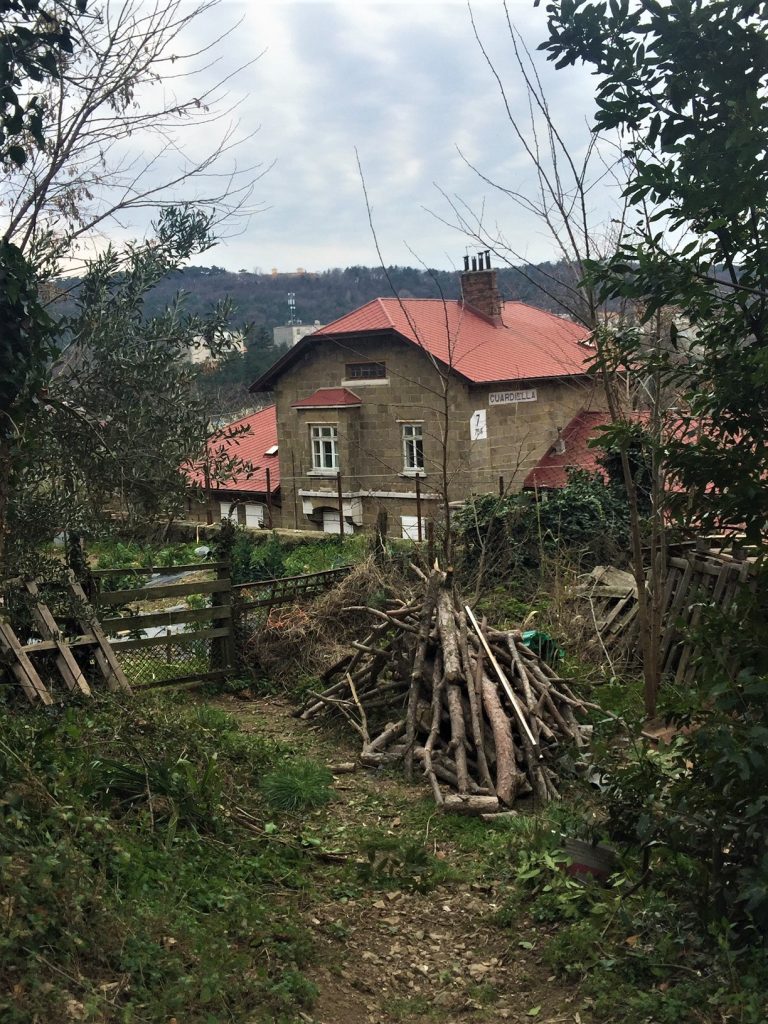
Once on the other side, follow via Damiano Chiesa until you reach via Masaccio. Take via Masaccio to the left, it will take you through the now partly abandoned Guardiella train station (more about ghost stations coming soon on InTrieste) and down some stairs to the beautiful neighborhood of upper San Giovanni.
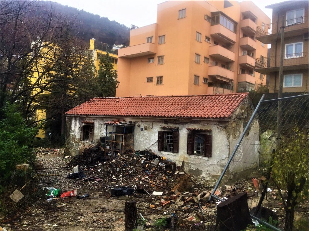
Before you go home, if you have some energy left, on your way downhill get lost in San Giovanni, once a farmers’ village surrounded by woods, today a popular neighborhood of Trieste where old and new merge into a variety of architectural styles. In recent years, tall, dull buildings have unfortunately been prevailing over the old tiny farmer houses that had managed to survive for centuries.


Very interesting article and pictures. Thanks Caroline
I love your articles. Being an old-timer Triestino living abroad several decades now, I’ve learned more about my birthplace by reading your comments than when I was living in my beautiful town. Thank you! Ed
Hi Allessandra…please let me introduce myself, I’m Shiri, an American from Seattle living in the last couple of years in beautiful Tel Aviv. I’m planning to visit Trieste on May 19th for a week and will be grateful for your kind advice
I love the outdoor and I’m looking to connect with people in Trieste sharing similar passion for hiking or biking around Trieste…
I’ll so much appreciate your kind advice on groups or individuals I may be able to reach out to in order to join such activities during my stay. Looking forward to hearing your reply, Thank you, Shiri my Whatsapp ±972504666972